Featured Product
This Week in Quality Digest Live
Metrology Features
Harish Jose
Using OC curves to generate reliability/confidence values
Scott Knoche
Choosing the best, most appropriate add-ons makes your work faster and easier
Adam Zewe
Key component for portable mass spectrometers
Peter Büscher
Identify contaminated areas and take steps to optimize them
Silke von Gemmingen
New approach investigates damage due to environmental fluctuation on textile artifacts

More Features

Metrology News
Improving quality control of PCBAs and optimizing X-ray inspection
10-year technology partnership includes sponsorship of quality control lab
MM series features improved functionality and usability
Features improved accuracy, resolution, versatility, and efficiency
Versatile CT solution for a range of 3D metrology, research, and evaluation applications
Adding its new SV series to NASCAR’s all-time leader in wins
Precise, high-speed inspection system makes automotive component production go faster
Upgrade to Mitutoyo’s latest CMM, vision, or form-measuring equipment
International Paper Co. saves money with Radian Plus laser tracker and vProbe

More News

CRC Press

Metrology

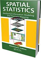
Book: Spatial Statistics: GeoSpatial Information Modeling and Thematic Mapping

How to extract information from remotely sensed imagery, GIS, and GPS

Published: Monday, May 16, 2011 - 10:13

(CRC Press: Boca Raton, FL) -- Geospatial information modeling and mapping has become an important tool for investigating and managing natural resources at the landscape scale. Spatial Statistics: GeoSpatial Information Modeling and Thematic Mapping, by Mohammed A. Kalkhan, Ph.D. (CRC Press, 2011) reviews the types and applications of geospatial information data, such as remote sensing, geographic information systems (GIS), and the Global Positioning System (GPS) as well as their integration into landscape-scale geospatial statistical models and maps. The book explores how to extract information from remotely sensed imagery, GIS, and GPS, and how to combine this with field data—vegetation, soil, and environmental—to produce a spatial model that can be reconstructed and displayed using GIS software. Readers learn the requirements and limitations of each geospatial modeling and mapping tool. Case studies with real-life examples illustrate important applications of the models.

Topics covered in this book include:
• An overview of the geospatial information sciences, and technology and spatial statistics
• Sampling methods and applications, including probability sampling and nonrandom sampling, and issues to consider in sampling and plot design
• Fine- and coarse-scale variability
• Spatial sampling schemes and spatial pattern
• Linear and spatial correlation statistics, including Moran’s I, Geary’s C, cross-correlation statistics, and inverse distance weighting
• Geospatial statistics analysis using stepwise regression, ordinary least squares (OLS), variogram, kriging, spatial auto-regression, binary classification trees, cokriging, and geospatial models for presence and absence data
• How to use R statistical software to work on statistical analyses and case studies, and to develop a geospatial statistical model


The book includes practical examples and laboratory exercises using ArcInfo, ArcView, ArcGIS, and other popular software for geospatial modeling. It is accessible to readers from various fields, without requiring advanced knowledge of geospatial information sciences or quantitative methods.

Author biography

Mohammed A. Kalkhan, Ph.D., has more than 20 years’ experience in research and teaching at Colorado State University (CSU). As a member of the Natural Resource Ecology Laboratory (NREL) there, he has also served as an affiliate faculty in the Department of Forest, Rangeland, and Watershed Stewardship, and as an advisor for the Interdisciplinary Graduate Certificate in Geospatial Science Graduate Degree Program in Ecology (GDPE), the School of Global Environmental Sustainability (SOGES), and the Department of Earth Resources (currently the Department of Geosciences) at CSU.

Kalkhan’s main interests are in the integration of field data, remote sensing, and GIS with geospatial statistics to understand landscape parameters through the use of a complex model with thematic mapping approaches, including sampling methods and designs, biometrics, determination of uncertainty and mapping accuracy assessment.

Discuss

About The Author

CRC Press’s picture

CRC Press

CRC Press is a premier global publisher of science, technology, and medical resources. It offers unique, trusted content by expert authors, spreading knowledge and promoting discovery worldwide. Its aim is to broaden thinking and advance understanding in the sciences, providing researchers, academics, professionals, and students with the tools they need to share ideas and realize their potential. CRC Press is a member of Taylor & Francis Group, an informa business.