{domain:"www.qualitydigest.com",server:"169.47.211.87"} Skip to main content

User account menu
Main navigation
  • Topics
    • Customer Care
    • FDA Compliance
    • Healthcare
    • Innovation
    • Lean
    • Management
    • Metrology
    • Operations
    • Risk Management
    • Six Sigma
    • Standards
    • Statistics
    • Supply Chain
    • Sustainability
    • Training
  • Videos/Webinars
    • All videos
    • Product Demos
    • Webinars
  • Advertise
    • Advertise
    • Submit B2B Press Release
    • Write for us
  • Metrology Hub
  • Training
  • Subscribe
  • Log in
Mobile Menu
  • Home
  • Topics
    • 3D Metrology-CMSC
    • Customer Care
    • FDA Compliance
    • Healthcare
    • Innovation
    • Lean
    • Management
    • Metrology
    • Operations
    • Risk Management
    • Six Sigma
    • Standards
    • Statistics
    • Supply Chain
    • Sustainability
    • Training
  • Login / Subscribe
  • More...
    • All Features
    • All News
    • All Videos
    • Contact
    • Training

Drones in Disaster Zones: How Advanced 3D Mapping Technology Can Help First Responders

NIST’s 3D indoor mapping competition is pushing technology forward

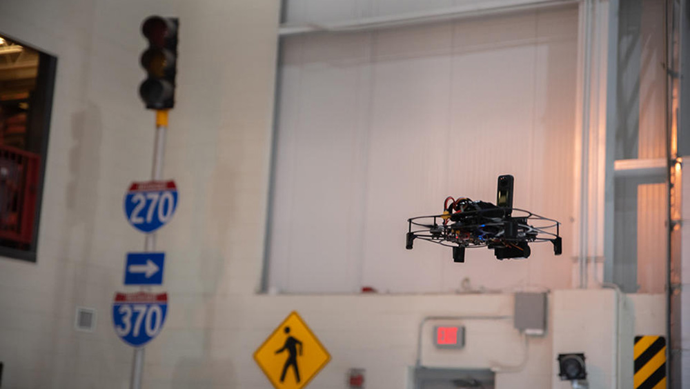
Flying an uncrewed aircraft system (UAS, or drone) in indoor environments can be challenging due to lack of GPS coverage and the need to maneuver through tight spaces. Credit: R. Wilson/NIST

Megan King
Wed, 02/26/2025 - 12:02
  • Comment
  • RSS

Social Sharing block

  • Print
Body

When first responders need to rescue people from an earthquake-ravaged home, they need real-time information. If law enforcement officers are looking for a shooter in a crowded building, they must learn everything they can about the scene. 

ADVERTISEMENT

Emergency responders need to know where people are and whether the building is structurally stable enough for them to attempt a rescue. 

But timely information can be scarce during a natural disaster or other dangerous incident. 

In many of these situations, sending an uncrewed aircraft system (UAS)—also known as a drone—into a building can provide lifesaving intelligence by capturing video footage, identifying potential hazards, and mapping the inside of the building. 


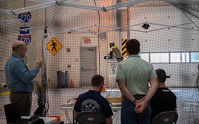
Judges watching the competition. Credit: R. Wilson/NIST

 …

Want to continue?
Log in or create a FREE account.
Enter your username or email address
Enter the password that accompanies your username.
By logging in you agree to receive communication from Quality Digest. Privacy Policy.
Create a FREE account
Forgot My Password

Add new comment

Image CAPTCHA
Enter the characters shown in the image.
Please login to comment.
      

© 2025 Quality Digest. Copyright on content held by Quality Digest or by individual authors. Contact Quality Digest for reprint information.
“Quality Digest" is a trademark owned by Quality Circle Institute Inc.

footer
  • Home
  • Print QD: 1995-2008
  • Print QD: 2008-2009
  • Videos
  • Privacy Policy
  • Write for us
footer second menu
  • Subscribe to Quality Digest
  • About Us
  • Contact Us